питер джефферсон (1708 - 1757)

Peter Jefferson was an American cartographer and surveyor, father of the third President of the United States, Thomas Jefferson.
Peter Jefferson was the son of a large landowner in Virginia, and served as sheriff, surveyor, and justice of the peace. He was also a cartographer and surveyor. Along with Colonel and County Surveyor Joshua Fry, he spent several years exploring new lands. In 1750, Lewis Burwell, acting governor of Virginia, commissioned Frye and Jefferson to map the colony, which was done.
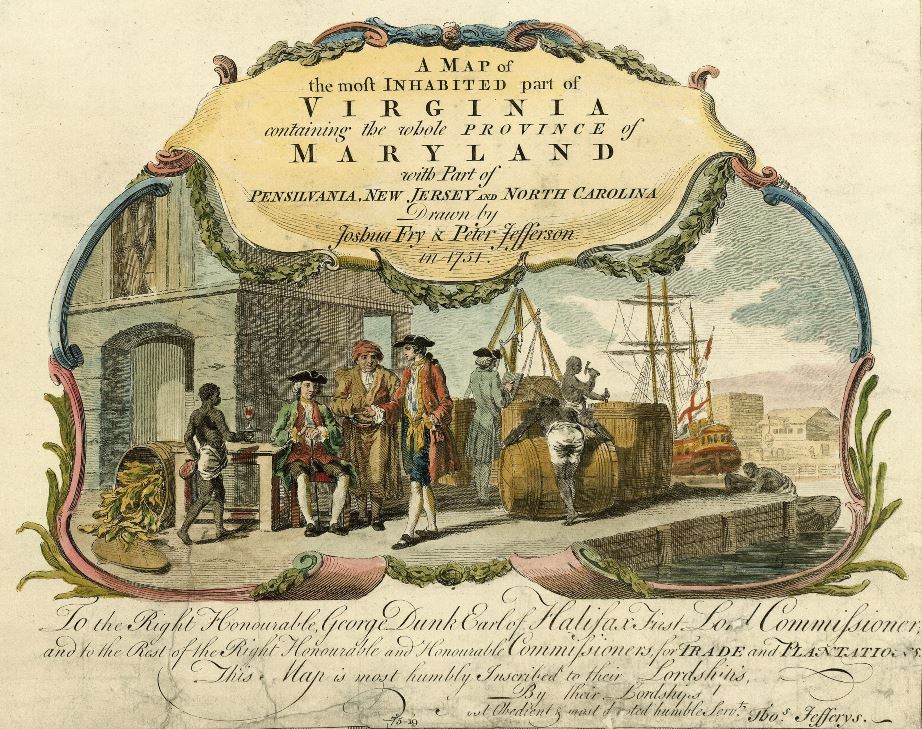
This map of early America was based on Frye and Jefferson's meticulous research and accurately delineated the boundaries, roads, settlements, and trails of the original inhabitants. It also included significant new geographic information reported by early wilderness travelers, including George Washington, Christopher Gist, and John Dalrymple. The map was completed in 1751 and engraved and published a few years later. Afterward, Jefferson worked on numerous surveying projects throughout Virginia.

Joshua Fry was a British and American politician and planter, surveyor and cartographer.
Educated at Oxford University, Fry emigrated to the colony of Virginia around 1726. He soon founded a grammar school for the sons of the local gentry, then headed the mathematics department of the college, and worked as a professor of philosophy. Through a successful marriage, he became a large landowner and gained prominence, serving as a member of the House of Burgesses and justice of the peace in Essex County and later in Albemarle.
When Albemarle County was established in Virginia in 1745, Joshua Fry was appointed here as chief surveyor in charge of land surveying. Beginning in 1746, Fry was assisted throughout his work by his close friend Peter Jefferson, father of future U.S. President Thomas Jefferson. Together they not only explored new lands, but also created maps that documented the new territories with great accuracy. Their main project was the so-called Frye-Jefferson map, published in 1751, depicting Virginia and Maryland.
This map was unique for its time because it was based on actual geodetic data. The map showed the "Great Road from the Yadkin River through Virginia to Philadelphia 455 miles."
At the outbreak of the Seven Years' War, Joshua Fry was appointed head of the Virginia Regiment and died of his injuries in the campaign on May 31, 1754.


Peter Jefferson was an American cartographer and surveyor, father of the third President of the United States, Thomas Jefferson.
Peter Jefferson was the son of a large landowner in Virginia, and served as sheriff, surveyor, and justice of the peace. He was also a cartographer and surveyor. Along with Colonel and County Surveyor Joshua Fry, he spent several years exploring new lands. In 1750, Lewis Burwell, acting governor of Virginia, commissioned Frye and Jefferson to map the colony, which was done.
This map of early America was based on Frye and Jefferson's meticulous research and accurately delineated the boundaries, roads, settlements, and trails of the original inhabitants. It also included significant new geographic information reported by early wilderness travelers, including George Washington, Christopher Gist, and John Dalrymple. The map was completed in 1751 and engraved and published a few years later. Afterward, Jefferson worked on numerous surveying projects throughout Virginia.


